Subject: Netherlands
Period: 1593 (published)
Publication: Speculum Orbis Terrae
Color: Hand Color
Size:
18.9 x 13.3 inches
48 x 33.8 cm
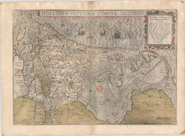
This very rare map depicts the Netherlands with north oriented to the right. It was issued in Cornelis de Jode's Speculum Orbis Terrae in 1593, which was a revised edition of an earlier atlas published by his father Gerard in 1578. The present map was one of the several new engravings in Cornelis' work. While the atlas did not have much commercial success, de Jode's maps are often regarded as superior in both design and cartographic detail to his more successful competitor, Abraham Ortelius. There was only one edition of Cornelis' Speculum produced, making this map quite rare on the market.
Cartographically, the map extends as far east as Nijmegen and Kampen and gives good detail of the Zuiderzee. A bird's-eye plan of the ruins of an ancient British castle is depicted along the coast near Den Haag. The map is adorned with various types of sailing vessels, a sea monster, and a strapwork cartouche. Latin text on verso.
References: Shirley (BL Atlases) T.JODE-1c; Van der Krogt (Vol. III) #3400:32B.
Condition: B
Full contemporary color with a dark impression that is a bit weak in the corners, with some printer's ink residue, two small worm holes in the image at bottom, and small remnants of non-archival tape along the far edges of the sheet. The map was separated along the length of the centerfold, which has been archivally repaired with a couple of tiny holes and small abrasions remaining along the centerfold.