Subject: Baltic, Latvia
Period: 1747 (dated)
Publication:
Color: Hand Color
Size:
22.1 x 19.3 inches
56.1 x 49 cm
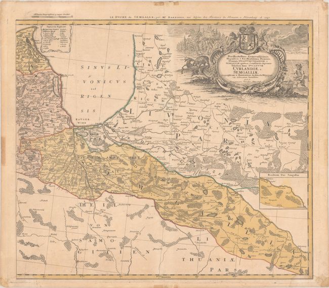
This is the eastern sheet (with its own borders) of a large two-sheet map of present-day Latvia that extends to show part of northern Lithuania as well. The eastern sheet roughly centers on Riga and covers from Cape Kolka east to part of Livonia and Duhnaburg (Daugavpils). Political divisions, towns and cities, rivers, lakes, and forests are located. A small inset at right shows more of the Duchy of Semigallia. A key identifies various types of towns and cities. The title cartouche includes a coat of arms for the Duchy of Courland and Semigallia, a fisherman, a dense wood, and a bear attacking a deer. Cartography is credited to Johann Christoph Barnickel. An alternate French title appears above the neatline: Le Duche de Semgalle... (western sheet).
References:
Condition: B+
A nice impression in full contemporary color on paper with a "ML" watermark. Light dampstains enter map image in the bottom corners, and there is minor soiling and toning. In the blank margins are light stains and a short centerfold separation at bottom. Old typewritten catalogue descriptions (in German) are attached on verso.