Subject: Baltic, Latvia & Estonia
Period: 1647 (circa)
Publication:
Color: Hand Color
Size:
19.5 x 15.1 inches
49.5 x 38.4 cm
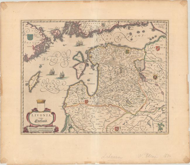
This handsome map covers the area of present-day Estonia, Latvia, and Lithuania, with the Baltic Sea. It extends to show the neighboring coastlines of Sweden and Finland and parts of western Russia and northern Belarus. The map is embellished with sailing ships, a title cartouche, and the coats of arms for Sweden, Finland, Estonia, Courland (Latvia), Lithuania, Moscovia, and Ingria. Dutch text on verso, published between 1647-61.
References: Van der Krogt (Vol. II) #1710:2.
Condition: B+
A crisp impression with full contemporary color and wide margins. There is faint toning and a few minor spots. In the blank margins are light tape stains and small chips and edge tears, all well away from map image. Remnants of hinge tape on verso.