Subject: Southern Norway
Period: 1671 (circa)
Publication:
Color: Hand Color
Size:
22.3 x 19.3 inches
56.6 x 49 cm
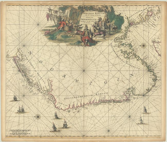
This beautifully engraved chart of southern Norway is oriented with north to the left. The map extends from about Stromstad, Sweden around to Bergen and north to above the 64th Parallel. There is great detail including rocks, shoals, anchorages, islands, and fjords. The map is embellished with rhumb lines, two compass roses, and numerous sailing ships, as well as a large title cartouche that features imagery representing important industries, such as fishing, mining, logging, and animal husbandry. This is the first state, prior to the addition of the sea names.
References: Carhart (de Wit) #C12.1; Ginsberg (Scandia) #73.
Condition: B+
A sharp impression with full contemporary color on a sheet with light soiling and toning along the edges. The map has been professionally backed in archival tissue to repair centerfold separations at top and bottom and several short cracks in the title cartouche.