Current Auction
Lot 361
Current Auction

"[On 2 Sheets] A New Map of Scotland, from the Latest Authorities", Cary, John
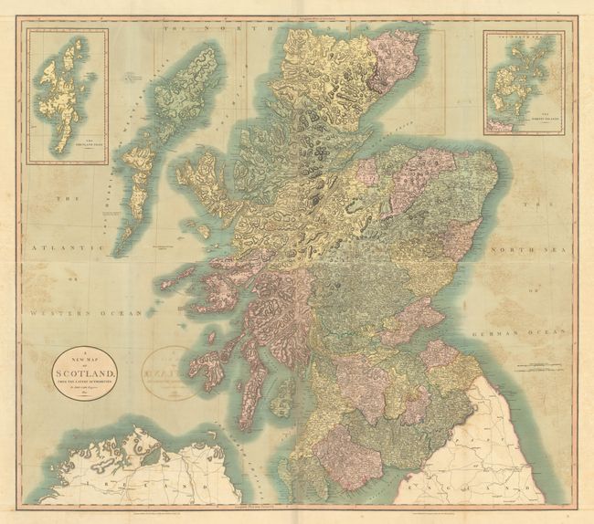
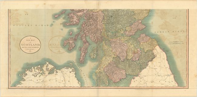
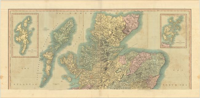
Subject: Scotland

Period: 1801 (dated)

Publication: Cary's New Universal Atlas

Color: Hand Color

Size:
40 x 17.8 inches
101.6 x 45.2 cm
Download High Resolution Image
(or just click on image to launch the Zoom viewer)

This handsome two-sheet English atlas map of the continent features numerous place names and impressive topographical detail. It extends to include the northern portion of Ireland and England with several notations touting fishing in the Atlantic including "Great Quantity of Cod Fish & Ling about the Islands" (Hebrides). The northern sheet also features inset maps of the Shetland and Orkney islands in the top corners. Engraved, published and sold by Cary at No. 181 Strand in London.

References:

Condition: B

Full contemporary color with moderate offsetting. The first image is a composite image - the map is in 2 separate sheets.

Estimate: $240 - $300

Sold for: $325

Closed on 6/18/2025

Closed