Subject: South Pole
Period: 1730 (circa)
Publication:
Color: Hand Color
Size:
18 x 18.1 inches
45.7 x 46 cm
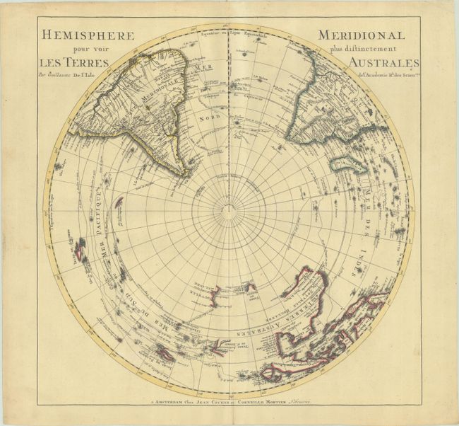
This is Covens & Mortier's edition of Delisle's map depicting the Southern Hemisphere. The map shows the tracks of the explorers and circumnavigators around the southern oceans including Magellan in 1520, Abel Tasman in 1642, and Edmund Halley in 1698-1700. The map provides very good detail, particularly of the explorations and discoveries in the South Pacific. Australia, New Guinea, Tasmania, and New Zealand are partially delineated, with Australia and New Guinea nearly attached to one another. Although Covens & Mortier's edition is nearly identical to Delisle's map cartographically, Cap de la Circoncision was added just south of Africa and also in an inset outside the hemisphere at bottom right based on the recent discovery by Jean-Baptiste Charles Bouvet de Lozier in 1739. The cape was part of Bouvet Island, later named after the explorer, and was not sighted again for nearly 70 years due to Bouvet mislabeling the coordinates of the land he sighted. Text panels surrounding the map were also added.
References: Tooley (Australia) p. xxxi, #42.
Condition: A
A sharp impression with contemporary outline color on a sturdy sheet with very minor soiling.