Subject: Western England
Period: 1680 (dated)
Publication:
Color: Hand Color
Size:
20.7 x 16.6 inches
52.6 x 42.2 cm
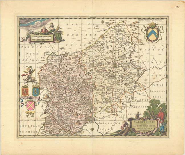
This exquisite map of the adjacent counties of Shropshire and Staffordshire is filled with detail of the hills, forests, estates, and towns. The map is richly embellished with cartouches touting the agriculture of the region, coats-of-arms, and putti. Petrus Schenk acquired this plate from Jansson's heirs and reissued the map with the imprint of his publishing partnership and with the addition of lines of latitude and longitude. Blank verso.
References: cf. Van der Krogt (Vol I) #5355:1.
Condition: B+
A crisp impression with full contemporary color that has been partially refreshed. There is some light color offsetting, faint toning outside the platemark, and archivally repaired centerfold separations confined to the top and bottom blank margins.