Subject: Northern England
Period: 1676 (published)
Publication: The Theatre of the Empire of Great Britaine
Color: Hand Color
Size:
20.2 x 15.2 inches
51.3 x 38.6 cm
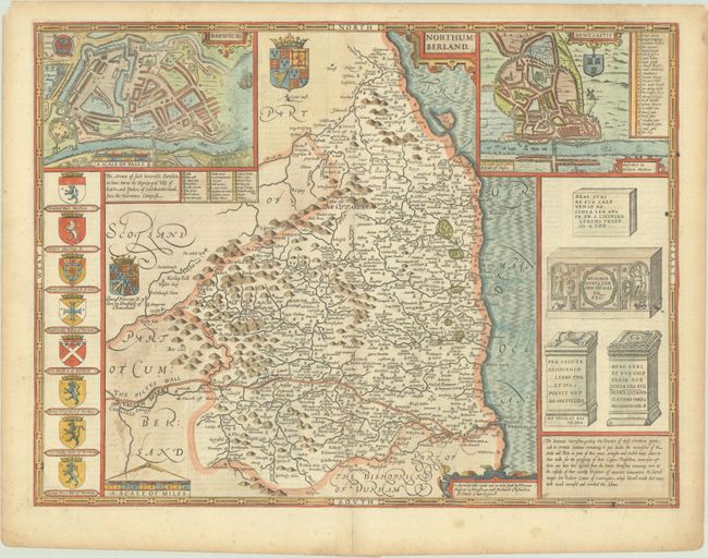
Speed's decorative map of Northumberland features bird's-eye plans of Berwick and Newcastle with keys identifying important locations. There is excellent detail in the map, including Hadrian's Wall, which is labeled as the Pictes Wall. To the left of the map are the coats of arms of important people in the county, and to the right are renderings of Roman antiquities. The imprint of Bassett and Chiswell is at bottom. English text on verso.
References: Shirley (BL Atlases) T-SPE-1j.
Condition: A
A nice impression on a sheet with a fleur-de-lis watermark and an archivally repaired centerfold separation in the bottom margin. There is light toning along the edges of the sheet and soiling in the blank margins.