Subject: Europe
Period: 1697 (published)
Publication:
Color: Hand Color
Size:
18.3 x 16.7 inches
46.5 x 42.4 cm
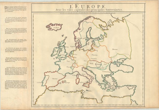
This teaching map gives only the outlines of each country and identifies the capitals. As the concept of a country capital had not yet been officially established, the selected capitals are based on the author's opinion. A column of text, printed on a separate sheet and pasted along the left side of the map, explains the reasoning behind why certain cities were selected as the capital. In Holland, both Amsterdam and the Hague were marked as capitals because Amsterdam is the largest and richest city in the country, but the Hague is where the States General convene. In Germany, Vienna was selected as it is the home of the Emperor. There are additional explanations for the capitals of Poland, the Savoy, Switzerland, the Low Countries, and Italy. Created by Louis Dangeau.
References: Rumsey #12205.026.
Condition: B+
A sharp impression with contemporary outline color on a lightly toned sheet with a bunch of grapes watermark, a few spots of foxing, and an archivally repaired centerfold separation at bottom.