Subject: Strait of Magellan & Tierra del Fuego
Period: 1777-87 (circa)
Publication:
Color:
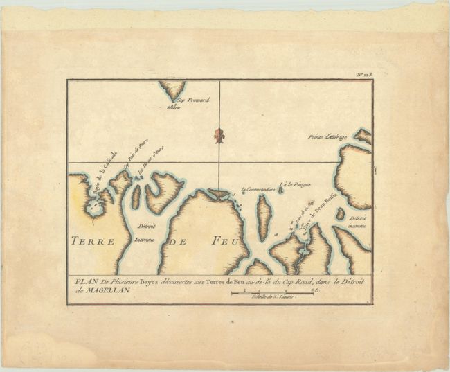
A. Plan de Plusieurs Bayes Decouvertes aux Terres de Feu au-de-la du Cap Rond, dans le Detroit de Magellan, by Etienne Andre Philippe de Pretot, from Atlas Universel, circa 1787, hand color (8.1 x 5.9"). This terrific small map features great coastal detail of Tierra del Fuego just south of Cape Froward. It identifies capes, bays, and small islands, with depth soundings in the water. Reference: Mickwitz & Miekkavaara #179-120. Condition: On a sheet with a bunch of grapes watermark. There is light toning and marginal dampstaining. (B+)
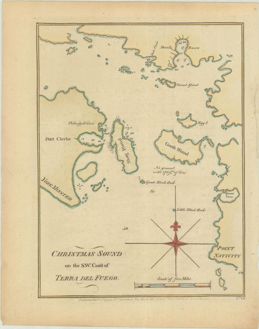
B. Christmas Sound on the S.W. Coast of Terra del Fuego, by (Capt.) James Cook, from A Voyage Towards the South Pole, and Round the World..., dated 1777, black & white (6.8 x 8.9"). This handsome chart shows Christmas Sound in Tierra del Fuego. Captain Cook traveled the coast of Tierra del Fuego in December 1774, during his second voyage. Cook and crew stopped in the sound over the Christmas holiday and performed maintenance on the Resolution, hence the name. The chart names islands and shows an anchorage and depth soundings. Reference: Shirley (BL Atlases) G.COOK-1a #12. Condition: A sharp impression on a sheet with minor toning and faint offsetting from an opposing page of text. (B+)
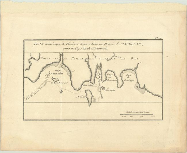
C. Plan Geometrique de Plusieurs Bayes Situees au Detroit de Magellan, Entre les Caps Rond et Forward, by Etienne Andre Philippe de Pretot, from Atlas Universel, circa 1787, hand color (8.8 x 5.1"). This small French chart zooms in on a section of the Strait of Magellan, centering roughly on Baye de Bougainville. The French navigator Louis-Antoine de Bougainville passed through the strait on his way to Tahiti during his circumnavigation (1766-69). Other bays named include Francoise, Bournand, and Bouchage. There are several anchorages, soundings, and hazards. Reference: Mickwitz & Miekkavaara #179-119. Condition: A crisp impression on watermarked paper with light dampstaining confined to sheet's edges. (A)
References:
Condition:
See description above.