Subject: South America
Period: 1780 (circa)
Publication: Atlas de Toutes les Parties Connues du Globe Terrestre
Color: Hand Color
Size:
8.3 x 12.6 inches
21.1 x 32 cm
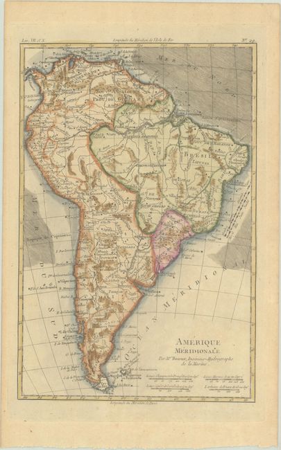
This detailed map shows extensive river systems and mountain ranges throughout the continent, much of which is spurious. A very later remnant of the mythical L. Parime appears in Guinea, and L. Xarayes is located in Matto Grosso. There are four distance scales beneath the title at bottom right and the direction of trade winds is depicted in the oceans.
Rigobert Bonne was an important French cartographer of the late 18th century. In 1773 he succeeded Jacques Bellin as the royal cartographer in the office of the Hydrographer at the Depot de la Marine. Working in his official capacity, Bonne compiled some of the most detailed and accurate maps of the period.
References:
Condition: B+
A crisp impression with very light toning.