Subject: Cap-Haitien, Haiti
Period: 1764 (circa)
Publication:
Color: Hand Color
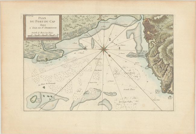
A. Plan du Port du Cap dans l'Isle de St. Domingue, from Le Petit Atlas Maritime, published 1764 (14.1 x 9.1"). This handsome chart focuses on a piece of the coastline of what is today Haiti. There is excellent topographical detail along the coast and a small plan of Ville du Cap (modern day Cap-Haitien). In the water depth soundings, hazards, and anchorages are shown. A compass rose topped with a fleur-de-lis orients the north to the bottom right corner. Condition: A crisp impression on a sheet with a Damien Tamizier watermark. There are a few light spots and marginal toning. (B+)
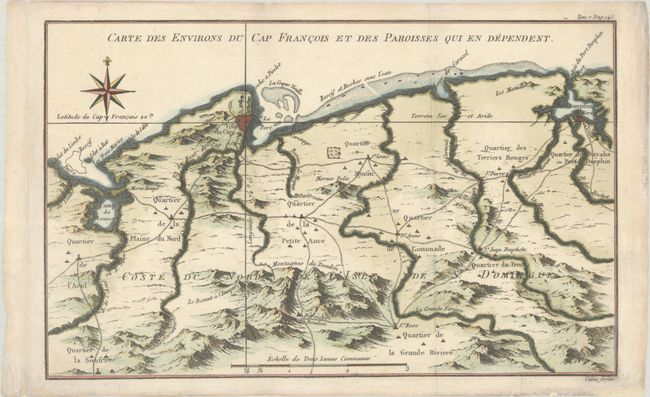
B. Carte des Environs du Cap Francois et des Paroisses qui en Dependent, circa 1764 (12.0 x 7.5"). This map covers the Haitian coast from the Riviere du Limbe east to Bahia de Manzanillo. It shows Ville du Cap (Cap-Haitien) and present-day Pepillo Salcedo, parishes, roads, and nicely rendered topographical detail. An ornate compass rose appears at top left. Engraved by Canu. Condition: A sharp impression on paper with a "TV" watermark and marginal soiling. (A)
References: Sellers & Van Ee #1877 & 1878.
Condition:
See description above.