Current Auction
Lot 278
Current Auction

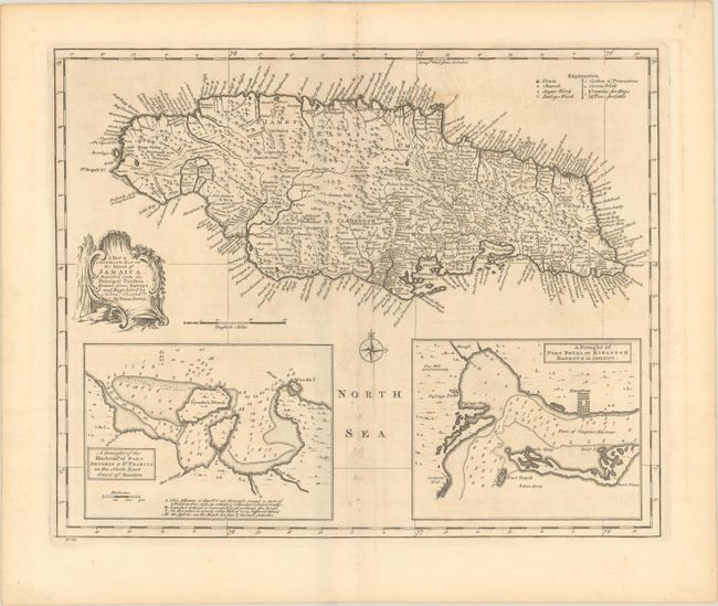
"A New & Accurate Map of the Island of Jamaica, Divided into Its Principal Parishes. Drawn from Surveys, and Regulated by Astronl. Observatns.", Bowen, Emanuel
Subject: Jamaica

Period: 1747 (circa)

Publication: A Complete System of Geography

Color: Black & White

Size:
16.6 x 13.5 inches
42.2 x 34.3 cm
Download High Resolution Image
(or just click on image to launch the Zoom viewer)

This highly detailed map of the island identifies towns, churches, sugar works, and indigo works. The map also locates numerous place names along the coast as well as rivers, roads, forests and topography. Features insets at bottom "A Draught of the Harbour of Port Antonio & St. Francis..." and "A Draught of Port Royal, or Kingston Harbor..." at bottom. Both insets are filled with soundings and shoals to aid in navigation. Adorned by a decorative title cartouche and compass rose.

References: McCorkle (18th c. Geography Books) #17-36 (Vol II); Shirley (BL Atlases) T.BOW-2a #66.

Condition: B+

A crisp impression on paper with a Strasbourg Bend & Lily watermark. There is minor offsetting and a bit of foxing along the centerfold.

Estimate: $150 - $180

Current High Bid:
$0

Reserve: Reserve Not Met
Next Bid: $75

Bid Increments
$50 - $99$5
$100 - $249$10
$250 - $499$25
$500 - $999$50
Terms & Conditions