Subject: Portobelo, Panama
Period: 1779-1809 (circa)
Publication:
Color:
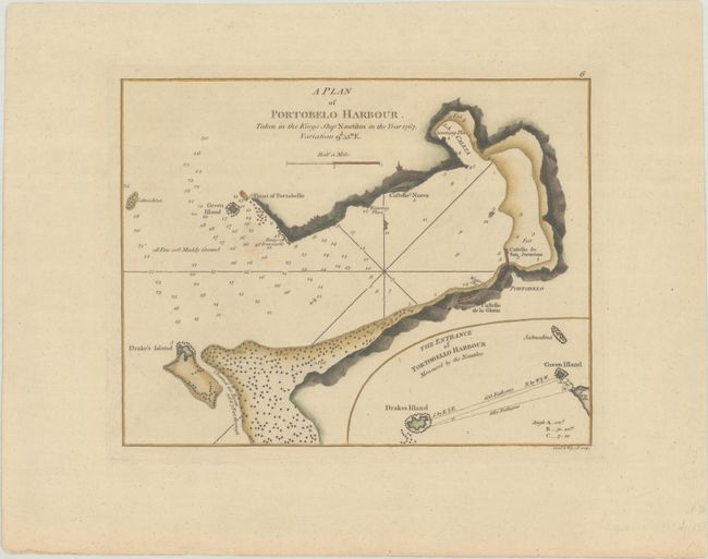
A. A Plan of Portobelo Harbour. Taken in the Kings Ship Nautilus in the Year 1767..., by Sayer & Bennett, circa 1794, hand color (8.8 x 6.9"). This lovely and uncommon small chart depicts the historic Panamanian harbor, showing Castello Nueva, Castello de San Jeronimo, Castello de la Gloria, and iron castle ruins along the coast. There is plenty of navigational information, including depth soundings, hazards, notes on bottom type, and an anchorage. An inset details The Entrance of Portobello Harbour at bottom right. Engraved by Creed & Wigzell. This is a later state, without the Sayer imprint. Trimmed from a larger sheet with another standalone chart of Zispata Bay. Reference: Kapp (MCC-73) #85-1; cf. Phillips (Maps) p. 728; cf. Shirley (BL Atlases) M.SAY-4a #6. Condition: A sharp impression on a sheet with a coat of arms watermark and a couple faint spots.
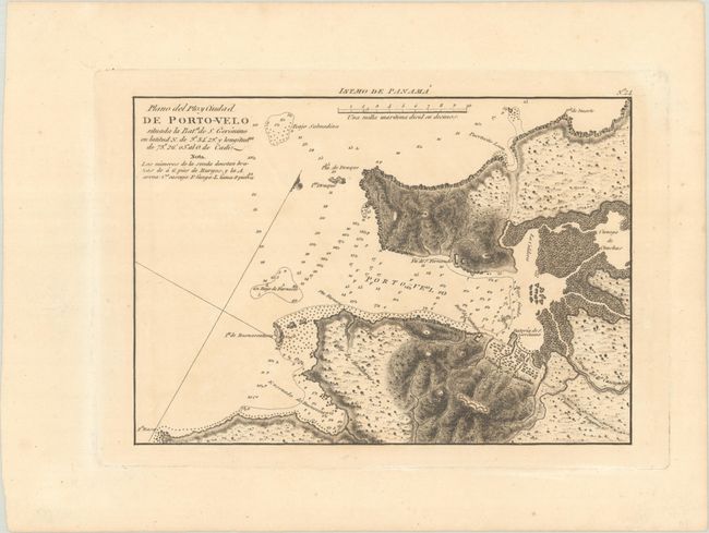
B. Plano del Pto. y Ciudad de Porto-Velo..., by Direccion de Hidrografia, from Portulano de la America Setentrionale, circa 1809, black & white (10.3 x 7.2"). This rare Spanish chart of Portobelo shows the city in miniature plan form as well as nearby forts. There is excellent topographical detail of the harbor's vicinity, and the waters are dense with navigational information. This is the first time we have seen this chart on the market. Reference: Kapp (MCC-73) #95-3. Condition: A dark impression with minor toning.
References:
Condition: A
See description above.