Subject: Nicaragua
Period: 1862 (dated)
Publication:
Color: Hand Color
Size:
9.9 x 16.6 inches
25.1 x 42.2 cm
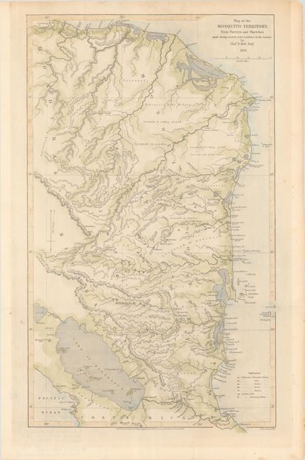
This handsome map of Nicaragua is based on surveys and sketches by Charles Napier Bell (1835-1906), a Scottish civil engineer who spent his early years on the Mosquito (or Miskito) Coast, eventually chronicling his time in the region in the ethnographic memoir Tangweera: Life and Adventures Among Gentle Savages (1899). The map covers Mosquito Country from Trujillo, Honduras south to the Nicaragua-Costa Rica border. A key at bottom right identifies settlements of the Miskitos and other indigenous groups, as well as falls and mahogany cuttings. There is excellent topographical detail, with elevations. Lake Nicaragua is prominently shown. Engraved by John Arrowsmith. Published by J. Murray for the Journal of the Royal Geographical Society.
References:
Condition: A
Issued folding with a couple minor spots and marginal toning. A few short fold separations in the blank margins have been closed on verso with archival materials.