Catalog Archive
Auction 204, Lot 259
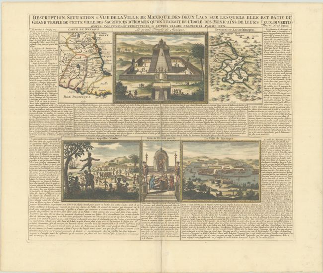
"Description, Situation & Vue de la Ville de Mexique des Deux Lacs sur Lesquels Elle est Batie, du Grand Temple de Cette Ville, des Sacrifices d'Hommes qu'on y Faisoit, de l'Idole des Mexicains...", Chatelain, Henry Abraham
Subject: Central Mexico & Mexico City
Period: 1719 (published)
Publication: Atlas Historique, Tome VI
Color: Hand Color
Size:
16.9 x 14.4 inches
42.9 x 36.6 cm
Download High Resolution Image
(or just click on image to launch the Zoom viewer)
(or just click on image to launch the Zoom viewer)