Subject: United States, Mexico & Central America
Period: 1832 (circa)
Publication: Geographical Annual or Family Cabinet Atlas
Color: Hand Color
Size:
5.7 x 3.7 inches
14.5 x 9.4 cm
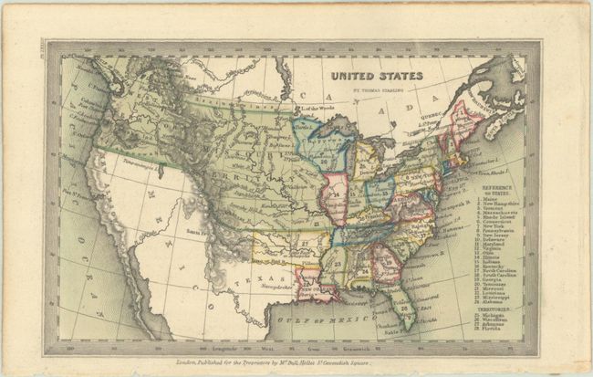
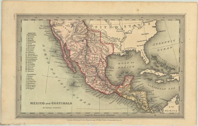
Two attractive maps appearing in Starling's very popular Victorian miniature atlas. Published by Bull and Holles.
A. United States. This map shows U.S. claims extending into British Columbia, with the Western Territory taking up the entire Pacific Northwest. The large Missouri Territory extends to the Canadian border. The entire present-day southwestern United States, north to Timpanangos L. and including Texas, is still part of Mexico. A numbered key at left indicates 24 states, and 4 territories: Michigan, Wisconsin, Arkansas, and Florida.
B. Mexico and Guatimala. A detailed map that delineates 21 provinces in Mexico and 8 in Guatemala. Locates numerous towns and villages, rivers, and mountains with a key at left naming the various provinces. Locates and names New California, Old California, New Albion and West Florida.
References: Phillips (Atlases) #4319-84 & 86.
Condition: A
Contemporary color with a hint of toning.


