Subject: World
Period: 1865 (dated)
Publication: New Illustrated Family Atlas
Color: Hand Color
Size:
23.2 x 16.5 inches
58.9 x 41.9 cm
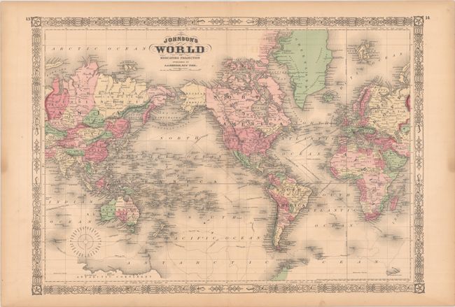
Centered on North America, this world map shows the tracks of Captain Cook and Captain Wilkes, as well as the Line of Atlantic Telegraph Cable between North America and Europe. Alaska is labeled Russian America on this early edition, and the place name Pembina appears in the vicinity of present-day North Dakota. Patagonia is depicted as its own region separate from the Argentine Republic in South America. Australia is divided into its states. The Antarctic Continent is still taking shape, with a couple stretches of coastline delineated. The map extends as far north as Grinnell Land. Surrounded by Johnson's classic decorative latticework border with stars in the corners.
References:
Condition: A
Full contemporary color with faint offsetting and light toning confined to the sheet's edges. Faint dampstaining just enters map border at bottom right.