Subject: New York City, New York
Period: 1939 (dated)
Publication:
Color: Printed Color
Size:
26.3 x 19.7 inches
66.8 x 50 cm
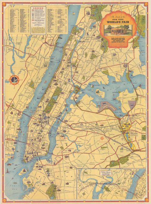
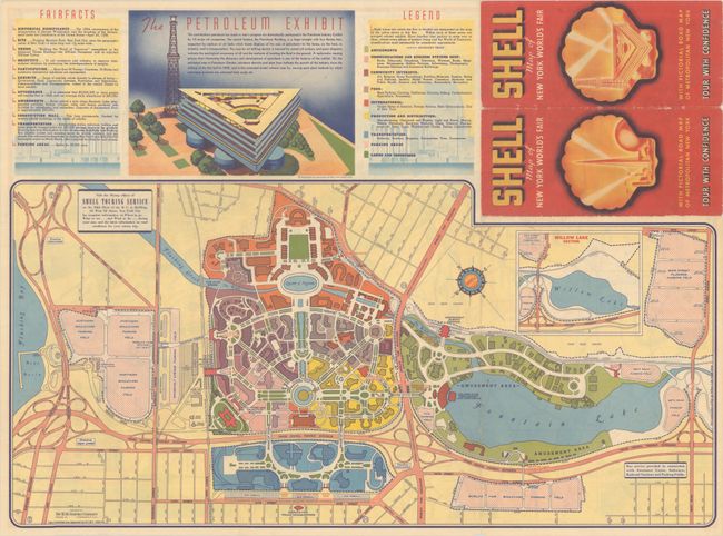
This pictorial road map was distributed by Shell for the 1939 World's Fair in New York. The map depicts Manhattan, the Bronx, and parts of Queens and Brooklyn. The "officially approved World's Fair routes" are marked in red, however most other main streets are also shown. Important buildings are illustrated, and there are tiny vignettes scattered throughout of people participating in various activities, such as golfing, painting and boxing. An inset map shows the Pulaski Skyway. On verso is a large map of the fairgrounds along with information on the petroleum exhibit at the fair.
References:
Condition: A
Light wear along the folds with small holes at fold intersections. There is a 0.5" tear and some extraneous creasing in eastern Bronx.