Subject: Glacier National Park, Montana
Period: 1914 (dated)
Publication: U.S. Geological Survey Bulletin 600
Color: Printed Color
Size:
32.2 x 28.5 inches
81.8 x 72.4 cm
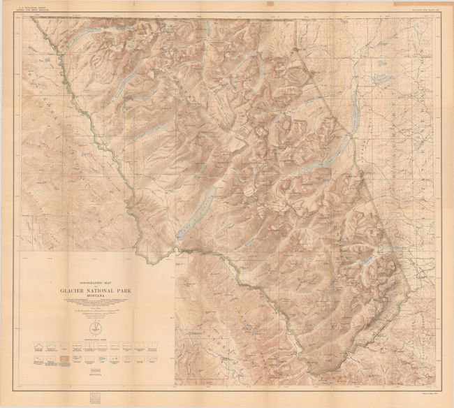
This stunning topographical map of the national park is intricately detailed and full of information. The park is bounded by a green line with Blackfeet National Forest to the west, Flathead Nation Forest to the south, and the Blackfeet Indian Reservation to the east. The legend below the title identifies roads, trails, railroads and stations, various boundaries, triangulation stations, bench marks, contours, streams, lakes, glaciers, springs, and marshes. The Great Northern Railway travels along the park's southern border and passes through the Continental Divide at Marias Pass. Edition of December 1914, based on the surveys of Chief Geographer R.B. Marshall from 1900-04 and 1907-12.
References:
Condition: B+
Issued folding on a lightly toned sheet with a couple of tiny splits at the fold junctions.