Subject: Montana
Period: 1910 (dated)
Publication:
Color: Printed Color
Size:
26 x 19.1 inches
66 x 48.5 cm
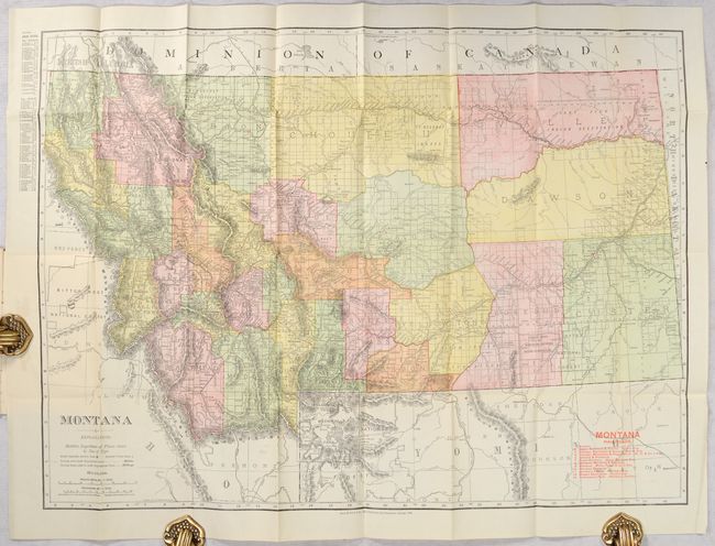
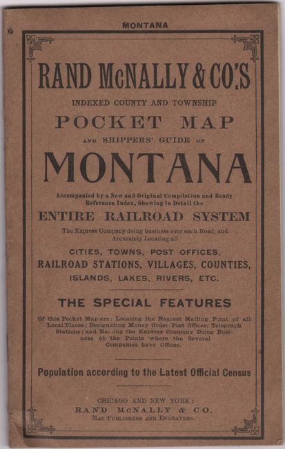
An attractive pocket map of the state issued 21 years after statehood. County configurations are current to 1909 with the addition of Lincoln County in the northwest corner of the state. The various railroads in the state are numbered in red overprinting which correspond to a table at lower right naming 14 railroads including the Chicago, Burlington & Quincy, Gilmore & Pittsburg, Montana, Wyoming & Southern, and many more. Most of the state has been surveyed, topography is well developed, and several Indian Reservations are named. Drawn on a scale of 23 miles per inch. Includes a 22-page index to place names, a list of U.S. land offices, and 7 pages of advertisements. Folds into beige paper wrappers entitled "Rand, McNally & Co.'s Indexed County and Township Pocket Map and Shippers' Guide Montana."
References:
Condition: A
Issued folding on a clean bright sheet with a bit of staining in the left blank margin where the map was glued to the rear cover. Paper wrappers have minimal wear.