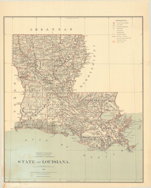
Subject: Louisiana
Period: 1879 (dated)
Publication:
Color: Printed Color
Size:
24.2 x 28.8 inches
61.5 x 73.2 cm
This detailed GLO map was drawn by C. Roeser, Principal Draughtsman while J.A. Williamson was Commissioner. It provides excellent detail of the entire state including towns and villages, rivers and roads. There is also good detail of coastal wetlands and waterways. The legend further identifies completed railroads, railroad limits, Private Grants, townships subdivided, partially subdivided and those "missing." Published in the Commissioner's annual report.
References:
Condition: B+
Mostly clean and bright with some light dampstaining in the lower left corner. The map has been stored rolled and does not currently lay flat on its own.