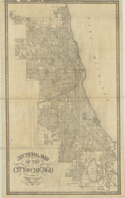
Subject: Chicago, Illinois
Period: 1914 (dated)
Publication:
Color: Black & White
Size:
30.4 x 51.3 inches
77.2 x 130.3 cm
A large and detailed street map of the city drawn under the direction of John Riley, Bureau of Maps, for the Department of Public Works. The map extends from Calumet Lake north to Caldwell's Reserve and presents the elaborate street-grid pattern of the city along with parks, cemeteries, canals and railroads. Surrounded by a decorative border identifying townships and ranges. We found only one past sales listing for this map and two institutional examples on OCLC (both Chicago institutions). Blank verso. Folded and backed with linen.
References:
Condition: B
Issued folding and backed on linen with several short splits at the fold junctions with minor image loss. Lightly toned with a few chips into the top left border and a minor ink stain along the lower left border. Ex-library with an old sticker on verso.