Subject: Honolulu, Hawaii
Period: 1948 (dated)
Publication:
Color: Printed Color
Size:
21.9 x 16.7 inches
55.6 x 42.4 cm
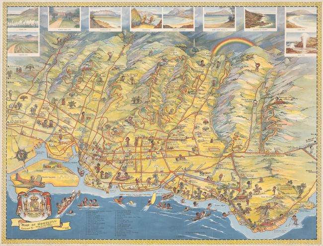
Henry B. Christian designed this charming pictorial map of Honolulu. The Aloha Tower, Punchbowl Crater, Hawaiian Pineapple Company (later Dole) headquarters, Honolulu Stadium, Kapiolani Zoo, and Diamond Head are among the sites graphically depicted on the map. The cartoony, large-headed figures that populate the map are similar in style to Ruth Taylor White's popular Hawaii maps. The playful illustrations show figures playing golf, handing out leis, fishing, hula dancing, taking scenic drives, making pottery, and several other recreational activities. A key at bottom left identifies 33 locations of interest, including Washington Place, Iolani Palace, and various government buildings, hotels, parks, schools, and more. Ten vignettes at top put the beautiful scenery on display. The map is further decorated by a compass rose, the coat of arms of the Hawaiian Kingdom, and a rainbow.
References: Rumsey #13174.
Condition: B+
A crisp and vivid example with minor foxing at left, some extraneous creasing, and some tiny edge tears and chips along the bottom edge, with a handful that just cross into map border.