Subject: Florida
Period: 1930 (dated)
Publication:
Color: Printed Color
Size:
11.4 x 15.6 inches
29 x 39.6 cm
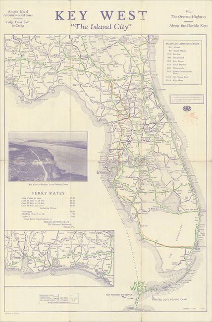
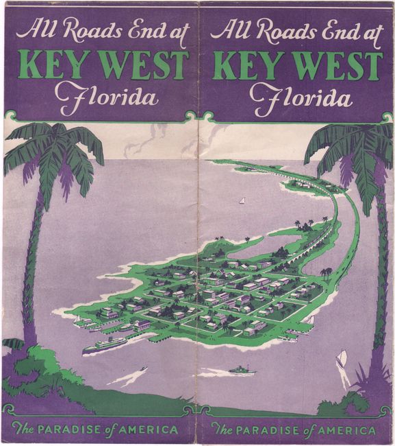
This map of the state presents the early road system with a legend at bottom identifying paved roads (solid green/blue), improved roads (doted green/blue), and earth roads (outline color). Includes an inset of western Florida at bottom and an aerial view of Pirate's Cove Fishing Camp at left. The brochure promotes "The Overseas Highway Along the Florida Keys" despite the journey to Key West still requiring a 36-mile ferry ride from Lower Matecumbe to Big Pine Key (the road wasn't completed until 1938). Related text and illustrations on verso. Folds into pictorial wrappers with a bird's-eye view of Key West. We found no past sales records for this map and only two institutional examples on OCLC.
References:
Condition: B+
Issued folding with a few tiny fold separations and some light colored pencil notations in the image.