Subject: San Jose, California
Period: 1886 (dated)
Publication:
Color: Hand Color
Size:
21 x 26.9 inches
53.3 x 68.3 cm
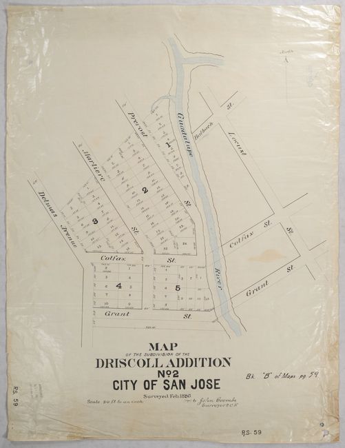
This manuscript survey of the Driscoll Addition was compiled by John Coombe and drawn on thin onionskin paper. It covers a small section of present-day southern San Jose, extending from Delmas Avenue northeast to Locust Avenue and from Balback Avenue south to Grant Avenue with the Guadalupe River at center. Land on the western side of the Guadelupe has been subdivided into 70 lots, each measuring approximately 50 x 138 feet. These lots were likely created to support the city's surging population. Drawn on a detailed scale of 80 feet per inch.
San Jose traces its origin to November 29, 1777, with the establishment of the Pueblo de San Jose de Guadalupe. The pueblo was relocated to what is now the modern downtown area in 1797. Following the United States’ annexation of California in 1848, San Jose was incorporated as the state’s second city (following Sacramento) on March 27, 1850 and served as its first capital. In 1870, there with only 9,000 inhabitants, but the city would quadruple in size over the next 50 years with nearly 40,000 residents by 1920.
References:
Condition: B+
Issued on thin onionskin paper with some minor staining and crinkling along the edges. There are a few small holes and old tape in the bottom right blank margin. Stamped by the City of San Jose at bottom left with several small ink notations on verso.