"A Cartograph of California's Picturesque Peninsula Where All the Charm and Beauty of California Is Found and Where All outdoors Is Yours", White, Ruth Taylor
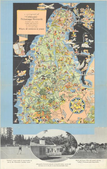
This is another of White's charming pictorial "cartographs," filled with whimsical images of people enjoying the sites and activities of San Mateo County. The map stretches as far south as Ano Nuevo Point and north to the Golden Gate Bridge (which opened in 1937) and Treasure Island, the site of the 1940 World's Fair. The major roads and a compass rose are included to help orient the traveler. This self-folding pamphlet (4.0 x 9.0"), entitled Find Your Place in the Sun down the San Francisco Peninsula, features text and numerous photographic images of points of interest throughout the county. Published by the San Francisco Peninsula Inc., which was established in 1938 to promote development of the peninsula beyond San Francisco. This is a smaller example of a map we listed in 2024, with no institutional examples located on OCLC.
References: cf. Rumsey #8822.
Condition: A
Clean and bright with minor wear along the fold lines.