Subject: Napa County, California
Period: 1940 (circa)
Publication:
Color: Black & White
Size:
19.9 x 31.8 inches
50.5 x 80.8 cm
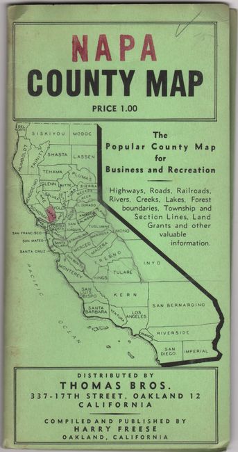
A highly detailed map "compiled, published, and copyrighted by Harry Freese" and distributed by Thomas Brothers in Oakland. Extends from Vallejo north to Knoxville and includes the towns of Napa, Sonoma, Saint Helena and Calistoga. A number of ranchos in the county remain unsurveyed including Petaluma, Catacoula, and Las Putas. A comprehensive legend at right further identifies various road types, bridges, railroads, airports, canals, parks, building types, and much more. A small inset map at top shows Napa County's relative size to other California counties. Lays into green paper wrappers. Price $1.
References:
Condition: A+
Clean, bright and fine. Paper wrappers have some minor wear and light pencil marks.