Subject: California
Period: 1910 (dated)
Publication:
Color: Printed Color
Size:
19.9 x 25.5 inches
50.5 x 64.8 cm
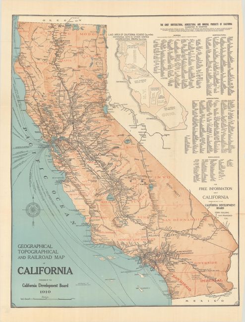
A detailed map of the state that is delineated by county and presents both the railroad network and shipping routes. Relief is presented with an attractive three-dimensional effect. An unusual inset map visually demonstrates how 10 other states would easily fit within California's footprint, and a table to its right presents the state's mineral and agricultural output. Issued by the California Development Board in its first annual report. To better promote the state, the Development Board was formed by merging the California State Board of Trade (established in 1890), the Manufacturers and Producers Association of California, and the California Promotion Committee. Its primary mission was to promote immigration and tout the state's economy.
References:
Condition: A
Clean and bright with some minor creasing at top. Issued folding on thin banknote-style paper.