Subject: World
Period: 1774 (dated)
Publication:
Color: Hand Color
Size:
26.1 x 18.8 inches
66.3 x 47.8 cm
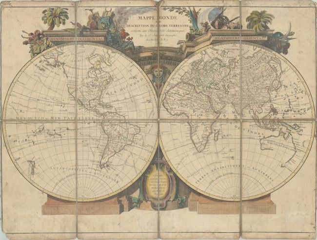
A lovely double-hemisphere map with a very decorative architectural surround with symbols from each of the four continents. The routes of several explorers are shown, including Anson, Mendana, Magellan, Le Maire, and Halley, along with their new discoveries. Australia is illustrated with an east coast and the southern coast of Tasmania is depicted, with conjectural lines linking Tasmania to the mainland. New Zealand is fully delineated, although Captain Cook's first Pacific voyage is not shown. In North America, the coastline of the Northwest is still rudimentary, with Alaska almost completely missing. There are only a few place names in North America, including El Paso along the Rio Grande, New Orleans, St. Augustin, Charleston, New York, Boston, Montreal and Quebec. Engraved by Lattre. This example was dissected and mounted on linen.
References:
Condition: B
Contemporary outline color in the map with later color in the cartouche, dissected and mounted on linen. There is moderate toning and soiling, light dampstains at bottom, and some chipping in the corners of the sheet, with minor loss of the neatline at bottom left.