Subject: Wyoming & Idaho
Period: 1883 (published)
Publication: Hayden's 12th Annual Report
Color: Printed Color
Size:
32.8 x 22.8 inches
83.3 x 57.9 cm
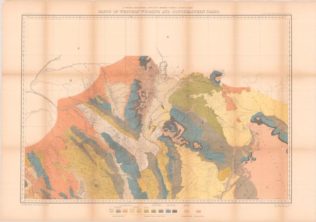
This map was issued in Hayden's 12th Annual Report for 1879, but was not published until 1883. It is roughly centered on today's Jackson Hole, Wyoming and extends to show good detail of Jenny and Leigh lakes, but the area of Yellowstone National Park is completely blank. Names John Gray's Lake, the Blackfoot River, Caribou Mt., Fremont's Pk., To-gwo-tee-a Pass, and much more. It provides a detailed examination of the Snake River and Blackfoot Range in Idaho and the Gros Ventre Mountains and part of the Wind River Range in Wyoming. In addition to topography, the map uses bold color and pattern to depict 12 different geologic types including recent deposits, sedimentary formations, metamorphic and eruptive rocks.
References: Wheat (TMW) #1296.
Condition: B
Issued folding with light toning along the fold lines and archival repairs to a number of fold separations on verso. There is minor loss at several fold junctions.