Subject: Colonial Southeastern United States
Period: 1747 (circa)
Publication: A Complete System of Geography...
Color: Black & White
Size:
17 x 13.7 inches
43.2 x 34.8 cm
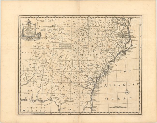
This detailed map covers the region from the Chesapeake Bay to St. Augustine, Florida and west to Pensacola Bay and the Country of the Cherokees. The map is derived from the Carolina sheet of Popple's great twenty-sheet map of North America (1733). It is most notable for its placement of forts and Indian villages. It also includes information on towns, early forts, mines, and several English Factories. Text at center describes the alliance made by the British with the Cherokees to provide a buffer against French and Spanish military advances. The title cartouche at top left features a pair of Indigenous figures and a shelter structure.
References: Cumming (SE) #263; McCorkle (18th C. Geog. Books) #17-29 (Vol II); Sellers & Van Ee #1380; Shirley (BL Atlases) T.BOW-2a #59.
Condition: B+
A crisp impression with a Lubbert van Gerrevink watermark. There is minor offsetting, a couple light spots, a tiny hole at left only visible when held to light, and two edge tears at bottom that have been closed on verso with old paper.