Subject: World
Period: 1748 (dated)
Publication: Atlas Nouveau Portatif
Color: Hand Color
Size:
11.8 x 8.8 inches
30 x 22.4 cm
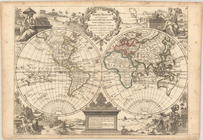
Charming double-hemisphere map with the female representations of the continents adorning each corner. The northwest part of North America has a conjectural coastline that juts out into the Pacific Ocean, which is adjacent to a complex river and lake system alluding to a Northwest Passage. Only four cities are noted in North America: Quebec, New Orleans, Mexico City, and Fort Francois in northern Mexico. Nouvelle Hollande is shown with the known coastlines connected between the mainland, Tasmania and New Guinea, creating an oddly shaped landmass. Northeast of Japan (labeled Niphon) are two islands named Terre d'Yesso (Hokkaido) and Terre de la Comp. (Company's Land).
George Louis le Rouge (fl. 1740-80) was one of the great French cartographers, rising to become the Geographer to the King. He was a military engineer prior to his career as a cartographer and his maps reflect the scientific approach that distinguish French mapmaking.
References:
Condition: B+
A watermarked sheet with contemporary outline color, minor toning along the centerfold, and light, scattered foxing. There is moderate toning along the edges of the sheet.