Subject: Eastern & Central United States
Period: 1833 (published)
Publication: Huntington's School Atlas...
Color: Hand Color
Size:
17.6 x 10.6 inches
44.7 x 26.9 cm
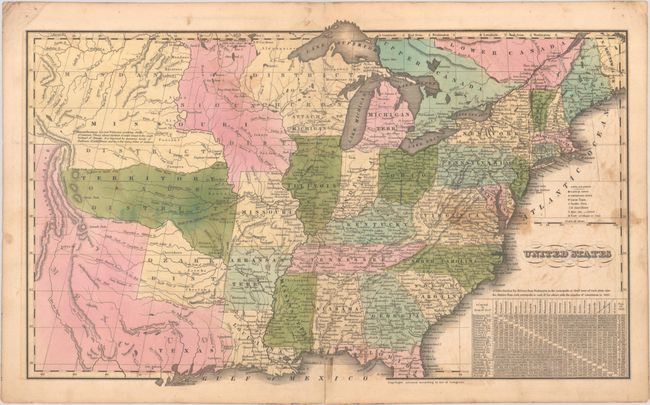
This interesting school atlas map of the United States stretches to the Rocky Mountains and shows Texas as a part of Mexico. A large Missouri Territory covers the middle of the country and is filled with Indian districts, including the Sioux, Mandan, Osage and Ozark tribes. The Upper Peninsula and present-day Wisconsin are shown as District of Huron and noted as "attached to Michigan." Arkansas is still a territory. A legend identifies capitals, important, large, and smaller towns, courthouses, missions, canals, forts, and colleges and universities. At bottom right is a table showing distances between Washington, D.C. and the principal cities of each state, with population figures.
References: Phillips (Atlases) #295-3.
Condition: B+
Contemporary color with some staining mostly at right and light offsetting. A 2.5" centerfold separation at bottom has been closed on verso with archival tape.