Subject: Passamaquoddy Bay & Bay of Fundy
Period: 1891 (dated)
Publication:
Color: Black & White
Size:
36.6 x 28.9 inches
93 x 73.4 cm
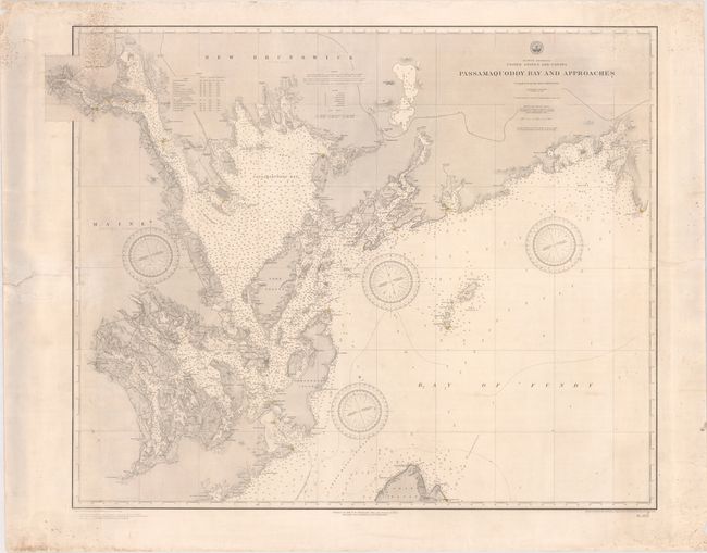
This detailed navigational chart focuses on Passamaquoddy Bay and the western portion of the Bay of Fundy, including the coastlines of parts of Maine and New Brunswick. The map extends along the St. Croix River to St. Stephen and Calais. The chart gives excellent detail of depth soundings, lighthouses (hand colored in yellow), and navigational notes, with topographical detail shown along the coastlines. The border between the United States and Canada is drawn with a dashed and dotted line. A chart of tides is given at top left. Drawn by L. Dessez and A. Klakring; engraved by C.E. Birch, M. Franke and J.L. Hazzard.
References:
Condition: B
A nice impression with lighthouses hand colored in yellow with some soiling, a couple of light creases, and small spots in the corners of the sheet that enter the map image. There are a number of small tears and chips along the edges of the sheet, as well as a tear that enters 2" into the image at left and another that enters 4" into the image at right that have been archivally repaired on verso.