Catalog Archive
Auction 203, Lot 693
NO RESERVE
"Habessinia seu Abassia at Ethiopia", Morden, Robert
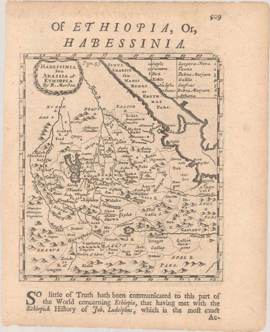
Subject: Eastern Africa
Period: 1688 (published)
Publication: Geography Rectified...
Color: Black & White
Size:
4.9 x 5.5 inches
12.4 x 14 cm
Download High Resolution Image
(or just click on image to launch the Zoom viewer)
(or just click on image to launch the Zoom viewer)