Catalog Archive
Auction 203, Lot 659

"La Chine avec la Coree et les Parties de la Tartarie les Plus Voisines Tirees des Cartes que les Jesuites Missionaires ont Levees les Annees 1708, Jusqu'en 1717", Bellin, Jacques Nicolas

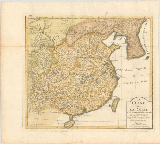
Subject: China & Korea

Period: 1756 (circa)

Publication:

Color: Hand Color

Size:
12.5 x 11 inches
31.8 x 27.9 cm
Download High Resolution Image
(or just click on image to launch the Zoom viewer)

This attractive and detailed map was based on the reports of Jesuit missionaries and depicts China and Korea. Canton (Quang Tong), Nanking, and Taiwan (Tay-Ouan ou Formose I.) are noted, as is the Great Wall of China. The Korean Peninsula is called Kao-Liqoue ou Roye. de Coree. There are plenty of place names and great topographical detail. A cartouche at bottom right encases the title and distance scale.

References:

Condition: B+

Issued folding, now flat, on a sheet with a "Malmenaide Auvergne" watermark, light foxing along a fold at left, faint offsetting, and a couple spots of errant colorist's ink.

Estimate: $160 - $190

Sold for: $80

Closed on 4/23/2025

Archived