Catalog Archive
Auction 203, Lot 632

"Carte de la Georgie &c. des Pays Situes Entre la Mer Noire et la Mer Caspienne...", Santini, P.
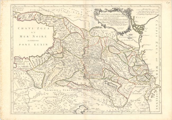
Subject: Caucasus

Period: 1766 (circa)

Publication:

Color: Hand Color

Size:
26.2 x 19.1 inches
66.5 x 48.5 cm
Download High Resolution Image
(or just click on image to launch the Zoom viewer)

Striking, large-scale map of the area between the Black and Caspian Seas displays political divisions and delicately engraved topography. It is based on a 1766 map by Joseph Nicholas Delisle, as credited in the ornate cartouche. There are two gold mines noted just south of Trabzon (Trapizoni).

References:

Condition: B+

A crisp impression with contemporary outline color on a bright sheet with the watermark of three stars. There is very light toning and offsetting along the centerfold, as well as foxing almost entirely confined to the left margin.

Estimate: $300 - $375

Sold for: $275

Closed on 4/23/2025

Archived