Subject: North America
Period: 1806 (dated)
Publication:
Color: Hand Color
Size:
8.6 x 7.3 inches
21.8 x 18.5 cm
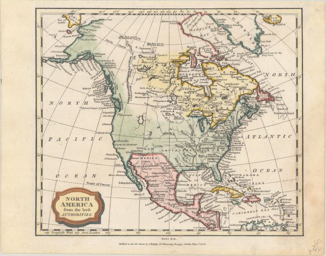
This fascinating small map of the continent shows the United States confined to the east of the Mississippi River. West and East Florida dominate the Gulf Coast east of the Mississippi. A town named Texas is located on the Rio Colorado, which runs into the Gulf of Mexico east of the Rio Grande, here Rio Bravo. The cartography of the West predates the Lewis & Clark expedition. The Stoney Mountains (Rocky Mountains) are depicted in Canada, but they do not extend into the present-day United States. There are two large unnamed lakes in the inter-mountain region, one in the vicinity of today's Idaho, the other farther south with the city of Teguayo on its southern shore. Alaska is in an early, but relatively well formed configuration, with the name labeling the Aleutian Peninsula. The discoveries of MacKenzie and Hearn are noted in northern Canada. Engraved by Barlow.
References:
Condition: A
A crisp impression with a minor dampstain that barely enters map image at bottom right.