Subject: Eastern Mediterranean & Middle East
Period: 1658 (circa)
Publication: Nieuwen Atlas
Color: Hand Color
Size:
20.6 x 16.3 inches
52.3 x 41.4 cm
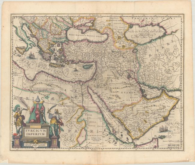
This is a very handsome map covering the Turkish Empire at the height of Ottoman rule, copied from Blaeu's map of 1635. The map spans from the Balkans to Persia and from Northern Africa through the Arabian Peninsula. It is embellished with a fine cartouche showing the Turkish Sultan on his throne and allegorical figures at either side brandishing weapons. Sailing ships can be seen in the Mediterranean and Arabian seas. Dutch text on verso, published 1645-58.
References: Tibbetts #87; Van der Krogt #8100:1B.1.
Condition: B+
A dark impression with full contemporary color with some printer's ink residue and a short centerfold separation in the top margin. There are archival repairs to a centerfold separation that enters 2" into the image at bottom and to several small chips and tears along the edges of the sheet.