Subject: Western Italy
Period: 1700 (circa)
Publication:
Color: Black & White
Size:
19.5 x 15.1 inches
49.5 x 38.4 cm
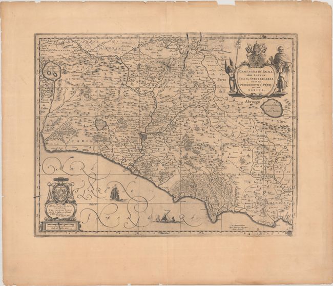
A nice copper engraved map of the region around Rome that extends from Lago di Bolsena to Gaeta. Rome is depicted in a block plan with its fortifications evident. Elegant script lettering, sailing ship and a galley embellish the sea. Two lovely cartouches further decorate this handsome chart, including a title cartouche featuring the Keys of St. Peter. Blank verso.
References:
Condition: B+
A dark impression but somewhat weak in the bottom right corner. There is light toning, some minor printer's ink residue, and centerfold separations confined to the top and bottom blank margins that have been closed on verso with archival tape. Small edge chips and edge tears are confined to the far blank margins, most of which have been closed on verso with archival tape.