Subject: Central Italy
Period: 1700 (circa)
Publication:
Color: Hand Color
Size:
19 x 14.9 inches
48.3 x 37.8 cm
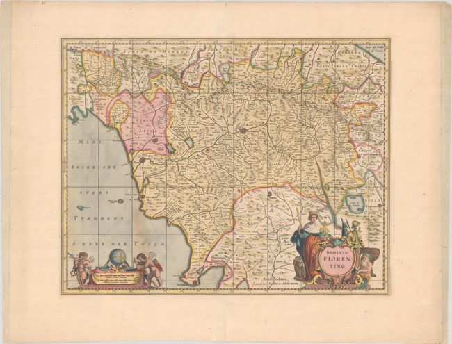
Jansson's highly decorative map of the Fiorenza region is one of the more desirable maps of Italy from this period. It details Tuscany showing the magnificent city of Florence at its center and extending to include Siena, Empoli, San Miniato, Perugia, Lucca, Pisa, Arezzo, and Cortona. Further north the cities of Cesena, Forli, Bertinoro, and Rimini are located. At bottom right is an elaborate figurative title cartouche featuring a king, a suit of armor, a river god, and a lion. The distance scale cartouche is topped by a globe and flanked by two putti with surveyor's tools. Petrus Schenk acquired the plate from Jansson's heirs and reissued the map with the imprint of his publishing partnership and with the addition of lines of latitude and longitude. Blank verso.
References: cf. Van der Krogt (Vol. I) #7200.1C.2.
Condition: B+
A fine impression in full contemporary color with a light stain at bottom left and a couple of minor horizontal extraneous creases. The margins at left and right have been reinforced and extended with old paper.