Subject: Italy
Period: 1603 (dated)
Publication:
Color: Hand Color
Size:
19.7 x 14.3 inches
50 x 36.3 cm
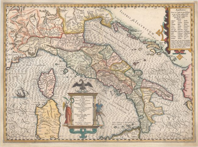
This handsome map of ancient Italy credits the cartographic information to Theodorus Cluver by Philip Cluver in an elaborate cartouche flanked by two figures representing peace and war. The map includes all of Italy, with Sardinia and Corsica but only the northern part of Sicily, and is filled with ancient place names. A strapwork cartouche at top right lists known authors who have written about Italy. The map is decorated with a large galleon at left. Blank verso, published circa 1635.
References: Van der Krogt (Vol. I) #7000H:1A.1.
Condition: B+
A sharp impression on a bright sheet with minor soiling in the corners of the sheet, faint ink notations within Dalmatia, and three tears at bottom that have been professionally repaired. The map has been professionally remargined on all sides with part of the border seamlessly replaced in facsimile.