Catalog Archive
Auction 203, Lot 564
"Tabula Geographica Exhibens Regnum Sclavoniae cum Syrmii Ducatu ex Mappa Grandiori Desumta et in Lucem Edita", Homann Heirs
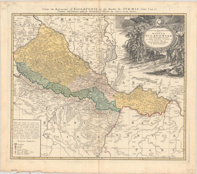
Subject: Serbia, Hungary & Croatia
Period: 1745 (dated)
Publication:
Color: Hand Color
Size:
22 x 18.3 inches
55.9 x 46.5 cm
Download High Resolution Image
(or just click on image to launch the Zoom viewer)
(or just click on image to launch the Zoom viewer)