Catalog Archive
Auction 203, Lot 552

"[Lot of 2] Mappae Imperii Moscovitici pars Septentrionalis, Adornata per Guillielmum de l'Isle... [and] Imperii Moscovitici pars Australis in Lucem Edita per Guillielmum de l'Isle...", Seutter, Matthias

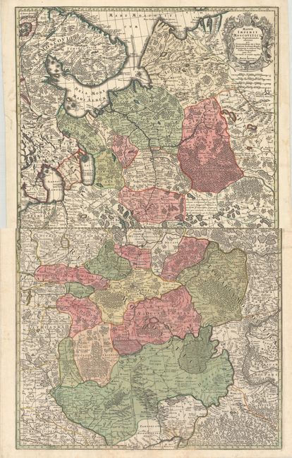
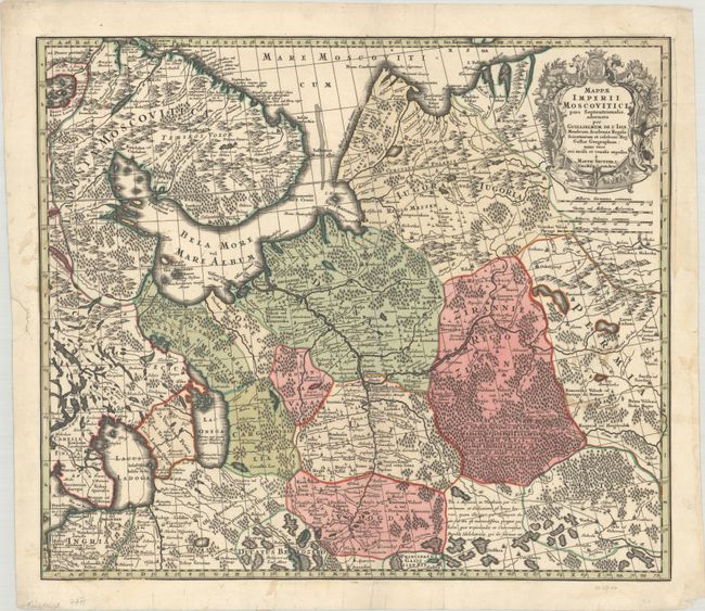
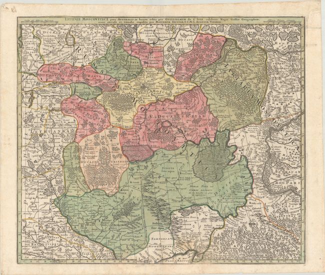
Subject: Russia in Europe

Period: 1730 (circa)

Publication:

Color: Hand Color

Size:
22.6 x 19.6 inches
57.4 x 49.8 cm
Download High Resolution Image
(or just click on image to launch the Zoom viewer)

This matched pair of maps divides western Russia into provinces and is based on Delisle's cartography. The maps are filled with countless place names, rivers, roads, swamps, and forests. The northern map focuses on the region south of the White Sea and includes St. Petersburg, Arkhangelsk, and Vologda. It features a decorative title cartouche containing images of wildlife, hunters, and a sleigh. This map of southern Russia and eastern Ukraine shows Moscow as a fortified city just north of center.

References:

Condition: B+

Sharp impressions with full contemporary color on bright sheets with light soiling. The northern sheet has a chip in the left margin and a couple of short edge tears that have been archivally repaired. The first image is a composite image - the map is on two separate sheets.

Estimate: $275 - $350

Sold for: $200

Closed on 4/23/2025

Archived