Catalog Archive
Auction 203, Lot 551
"La Russie Blanche ou Moscovie Divisee Suivant l'Estendue des Royaumes, Duches, Principautes, Provinces et Peuples...", Sanson/Jaillot
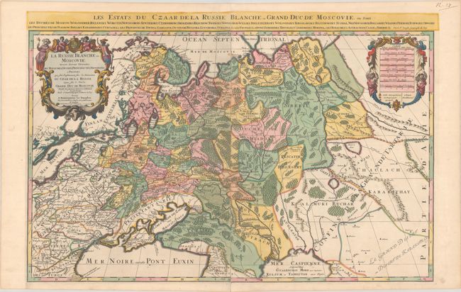
Subject: Russia in Europe
Period: 1700 (circa)
Publication:
Color: Hand Color
Size:
34.9 x 21.6 inches
88.6 x 54.9 cm
Download High Resolution Image
(or just click on image to launch the Zoom viewer)
(or just click on image to launch the Zoom viewer)