Subject: Eastern Europe, Poland
Period: 1730 (circa)
Publication:
Color: Hand Color
Size:
23.1 x 19.9 inches
58.7 x 50.5 cm
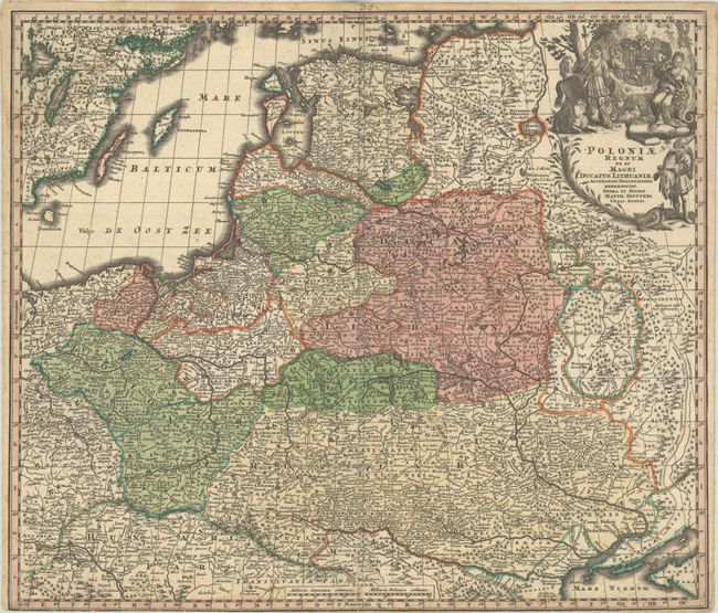
This handsome German map of Eastern Europe and the Baltic roughly centers on Lithuania. In the north, it spans from Stockholm across the Baltic to Noteborg, the site of a siege in 1702 during the Great Northern War, near present-day St. Petersburg; in the south, it stretches from Vienna to the northwestern portion of the Black Sea. As is typical with German maps of this period, there is great detail of political divisions, place names, and topography. The Muravsky Trail, a trade route that the Tartars used to raid Moscow during harvest season, is delineated in the east. There is an elaborate title cartouche at top right featuring a coat of arms, allegorical figures, livestock, and a fur trapper.
References:
Condition: B
A nice impression with full contemporary color, light dampstaining in the top corners, a pair of tiny wormholes in the border, a short printer's crease at bottom right, and a few short edge tears that have been closed on verso with archival tape. There are archival repairs to a separation along the centerfold and to an adjacent 1.5" tear. The margin has been trimmed to neatline at bottom left.