Subject: Czech Republic
Period: 1770 (circa)
Publication:
Color: Hand Color
Size:
22 x 18.8 inches
55.9 x 47.8 cm
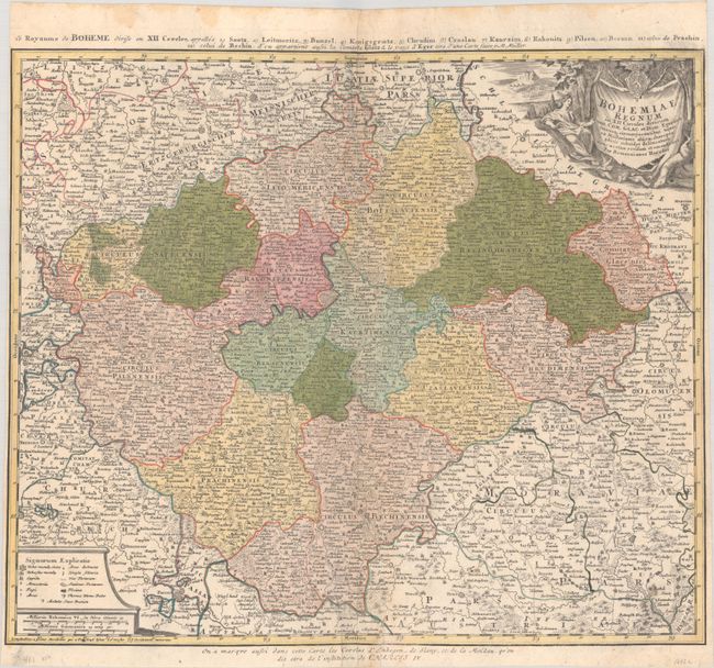
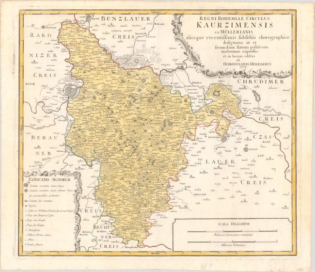
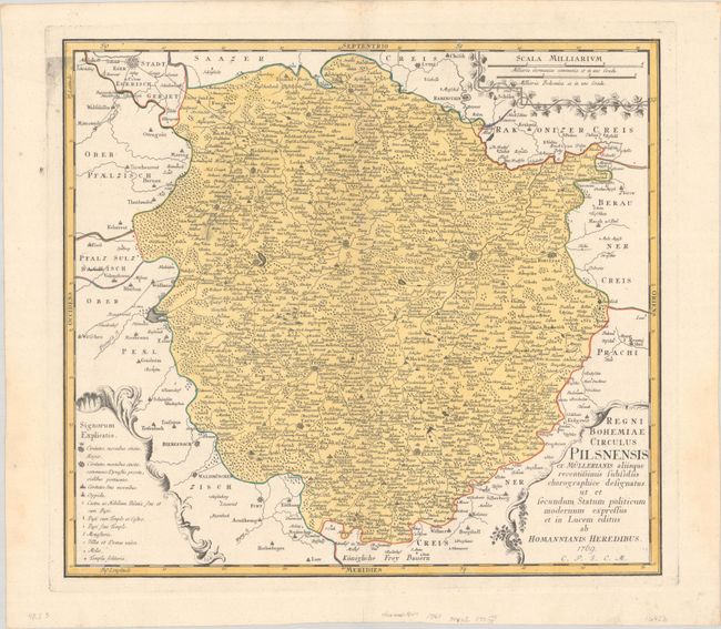
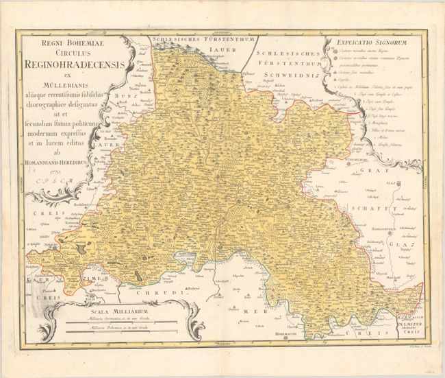
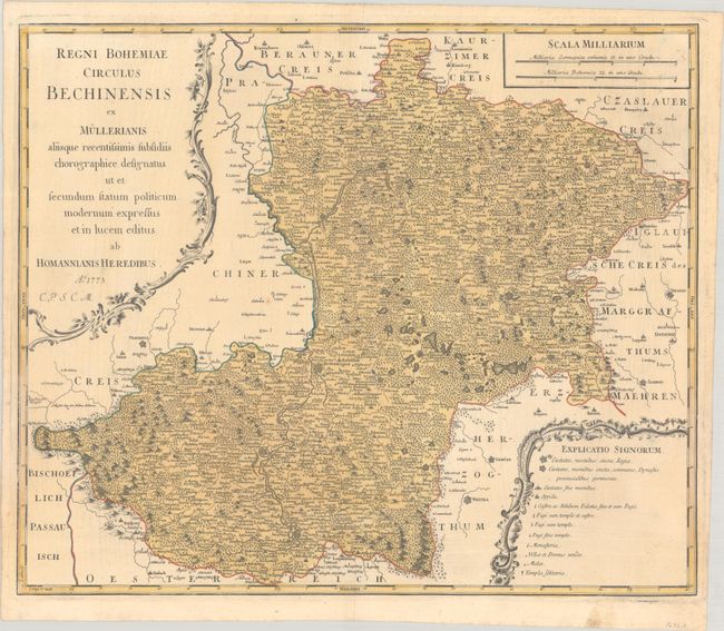
This remarkable set of maps focused on the western Czech Republic includes an index sheet and 12 detailed maps of the region. The index sheet is centered on Prague and extends in the northwest to Plauen and to Gaya in the southeast, locating Glatz, Leypa, Pilsen, Toplitz, Saatz, Eger, Mies, Wodnian, Pistritz, Landscron and many more. It locates hundreds of towns and villages with the larger cities shown as fortified. A pictorial cartouche fills the upper right corner with a female figure representing the harvest, with a number of hunted animals at her feet.
The index sheet also delineates each of the twelve "circles" (Circulos) which correspond to the 12 detailed maps. Detailed maps feature numerous towns and villages, rivers, and topography. Each is decorated by two strapwork cartouches and a distance scale.
References:
Condition: B+
The maps are mostly very good to near fine with full contemporary color and occasional printer's ink residue. The index sheet has some archival repairs along the centerfold and narrow side margins. Three detailed maps are in good condition (B) with some dampstaining mostly along the edges of the maps.