Subject: Southern Germany
Period: 1659 (circa)
Publication:
Color: Hand Color
Size:
20.9 x 16.4 inches
53.1 x 41.7 cm
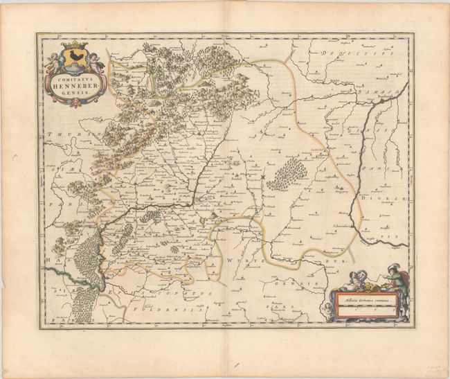
This lovely map is oriented with north to the left and is centered approximately on Henneberg and features the cities of Bamberg, Schweinfurt, Meiningen, and Vacha. The map details forests, mountains, rivers and political boundaries and identifies dozens of tiny towns. Adorned with two strapwork cartouches featuring putti and a surveyor. Spanish text on verso, published between 1659-72.
References: Van der Krogt (Vol. II) #2570:2.
Condition: A
A sharp impression with full contemporary color on a bright sheet with a large watermark of the god Atlas. There is a hint of offsetting, a pair of tiny worm holes near the center of the image, and minor toning along the edges of the sheet.