Subject: Germany
Period: 1960 (circa)
Publication:
Color: Printed Color
Size:
38.1 x 32.1 inches
96.8 x 81.5 cm
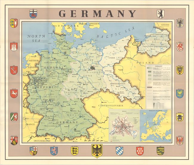
This map shows the boundaries of Germany between 1937 and 1949, illustrating how Germany was subdivided as a result of the Potsdam Agreement on 2 August 1945. A colored key at right identifies the various regions, including the Soviet Zone and the regions under Polish and Soviet administration. Western Germany is labeled as the Federal Republic of Germany, which was established in 1949. The populations of each region are also given within the key based on data between 1937-1960. Two insets depict Germany's location within Europe and a plan of Berlin. The map border features the coats of arms of 20 regions as well as the arms of Germany at bottom center. Publication information for this map is unknown.
References:
Condition: A
Clean and bright, issued folding with minor wear along the folds.